A one story cinderblock building sits on a low rise just beyond the park. The row of numbered doors is nearly obscured by overgrown shrubbery and prairie grass grows patchy over the parking lot. The sign out front: removed. There’s no place for a traveler to stay here.
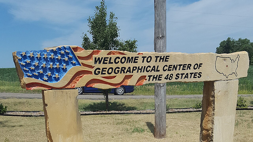
The Geographic Center of the United States
Latitude 39 50 Longitude 98 35
Located by Lt. Hagadorn, Paulette & Wilson Engineers and L.A. Beardslee, County Engineer
From Data Furnished by the U.S. Coast and Geodetic Survey
Sponsored by the Lebanon Hub Club, Lebanon, Kansas, 1940
Dorrie turns from the marker, a bronze plaque affixed to a pyramid of stones held together by masonry. She surveys the park. There’s a picnic table on a concrete slab, a barbeque pit with a blackened grate over the top. A small tree, a few shrubs.
Dorrie Spill
Lebanon, Kansas
Dear U.S. Cost and Geodetic Survey,
It is my understanding that you provided Lt. Hagadorn and L.A. Beardslee, with the data necessary for determining the geographic center of the United States. I would like to request your help with similar information.
I have lost my equilibrium, and I cannot find my center. Any guidance you can provide will be appreciated.
Thank you for your assistance,
Yours,
Dorrie Spill
U.S. Coast and Geodetic Survey DOC/NOAA
National Geodetic Survey N/NGS12
1315 East-West Highway
Silver Spring, MD 20910
Dear Ms. Spill,
In 1940, the geographic center of the United States was fixed in Lebanon, Kansas. With the entry of Alaska as the 49th state, the geographic center was refigured, and fixed in Butte County, South Dakota. The admission of Hawaii into the Union caused the center to be moved again, this time to a point six miles southwest of the previous pint, though still in Butte County. Things change. We all do our best to keep up.
Sincerely,
Geodetic Survey
On the other side of the park there’s a small trailer, painted white. A hitch extends from the back, wheel attachments sink into the earth. On the tarpaper roof, there’s a boxy steeple topped with a white cross. Hand lettering over the doorway reads: US CENTER CHAPEL. Dorrie turns the handle of the door and enters.
Dorrie Spill
Lebanon, Kansas
Dear U.S. Cost and Geodetic Survey,
It’s true that my life is in flux. There’s been a shake-up. A break up. But actually, my center was missing before. That was the problem. The sense of a shriveled nucleus, diminished and gone astray to the farthest reach of some no-place wasteland. Unreachable.
Yours,
Dorrie Spill
Inside the trailer, it’s close and still. The floor is covered with wall-to-wall green artificial turf. Four miniature one-seater pews face a miniature lectern. Behind the lectern, there’s a large cutout of the United States, the lower 48 painted over with the stars and stripes of the American flag. Affixed to the middle of the cutout, there’s a wooden cross, and at the T of the cross, a wooden heart. It sounds like a lot. It sounds like a lot of symbolism for one kitchy wall decoration, but reality is reality and that is how it is.
U.S. Coast and Geodetic Survey DOC/NOAA
National Geodetic Survey N/NGS12
1315 East-West Highway
Silver Spring, MD 20910
Dear Ms. Spill,
The land encompassing the actual location of the geographic center of the United States, calculated with the inclusion of Alaska and Hawaii, is a treeless rolling prairie, home to wildlife such as deer, prairie dogs, and rattlesnakes. In 1993, there were eight incidents of rattlesnake confrontation with visitors to the marker, at which point the marker was moved to the town of Belle Fourche, approximately twenty-two miles to the south, on the theory that an approximation is better than a hazard. Safety first, Dorrie.
Sincerely,
Geodetic Survey
Dorrie moves a few paces down the aisle and steps behind the lectern. She places her hands on either side of it. She faces a congregation of none.
Dorrie Spill
Lebanon, Kansas
Dear U.S. Cost and Geodetic Survey,
Will I know it if I find it?
Yours,
Dorrie Spill
U.S. Coast and Geodetic Survey DOC/NOAA
National Geodetic Survey N/NGS12
1315 East-West Highway
Silver Spring, MD 20910
Dear Ms. Spill,
The geographic center of the North American continent is a point of some dispute. On American soil (it is our understanding that Canadian officials have designated a point as well), markers have been placed both north of Pierre, South Dakota and in Rugby, North Dakota. Axis is as Axis does. We all live with a certain amount of ambiguity.
Sincerely,
Geodetic Survey
Dorrie Spill
Lebanon, Kansas
Dear U.S Coast and Geodetic Survey,
Where do I go from here?
Yours,
Dorrie Spill
U.S. Coast and Geodetic Survey DOC/NOAA
National Geodetic Survey N/NGS12
1315 East-West Highway
Silver Spring, MD 20910
Dear Ms. Spill,
That is a good question, and one we encourage you to pursue, to the best of your ability, which appears to be compromised. However, as we are unable to respond to inquiries regarding population distribution, we have forwarded your correspondence to the United States Census Information Center and closed your file.
Sincerely,
Geodetic Survey
Dorrie steps out from behind the lectern. She moves down the aisle. To the left of the chapel door, there’s a clipboard on the wall holding a page with columns drawn by hand: Name, State, Comments.
Dorrie Spill, our Dorrie does not write. Lost, she does not write, or further comment on this middle in which she finds herself, mid-flight, equidistant from the sketchy limit-borders of before and after, stumbling over the crux of the matter.
Evan Harris is the author of The Quit, a satire of the self-help genre. In the past, her short fiction was published in The Iowa Review, Fence, The Brooklyn Rail, Story, and Fairy Tale Review among other publications. Most currently, her flash fiction has appeared online in Bending Genres, and Fictive Dream. She writes book reviews for her home town newspaper The East Hampton Star.